Keléstia Productions is proud to announce the release of our latest interactive map for the region of Shôrkýnè. This map covers the realms and principalities of Hârbáal, Chélemby, Huriséa and Shôrkýnè, as well as touching on parts of Emélrenè, Quârphor, Lánkor, and Tríerzòn.
This map is a designed to support and complement a range of current and future Keléstia Productions publications, including our Chélemby and Lédenheim publications.
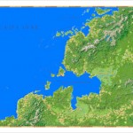
The map includes all of the geographical and settlement features from N. Robin Crossby’s original Shôrkýnè map, with many additional features identified. There are more than 1,100 geographical and settlement features on this map, which are listed in the accompanying 8-page index.
This map is in the same style as the Hârn Interactive Map, providing the same level of functionality and flexibility. In addition, a ‘vector-only’ version of the map is provided for those wanting ready and speedy access the wealth of information which supports this map.